|
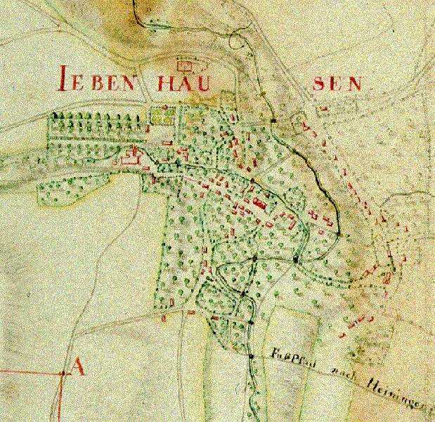
Let us start our visit to the village in 1788
- eleven years after the first Jews have settled in Jebenhausen.
The village belongs to the Baron of Liebenstein.
His castle, with the adjacent park, is situated at the Western edge of
the village.
The map shows the Christian village with its houses,
stables and barns surrounded by green gardens and fields. On the other
side of that little brook the first Jewish settlers have built their houses
along the road to Goeppingen, a near-by town in the Duchy of Wuerttemberg.
Move your
mouse over the map and click on a part of the village you would like
to explore,
or click
here
to continue!
|